EXTERNAL REFERENCE · ORANGE COUNTY
Seeing the whole community
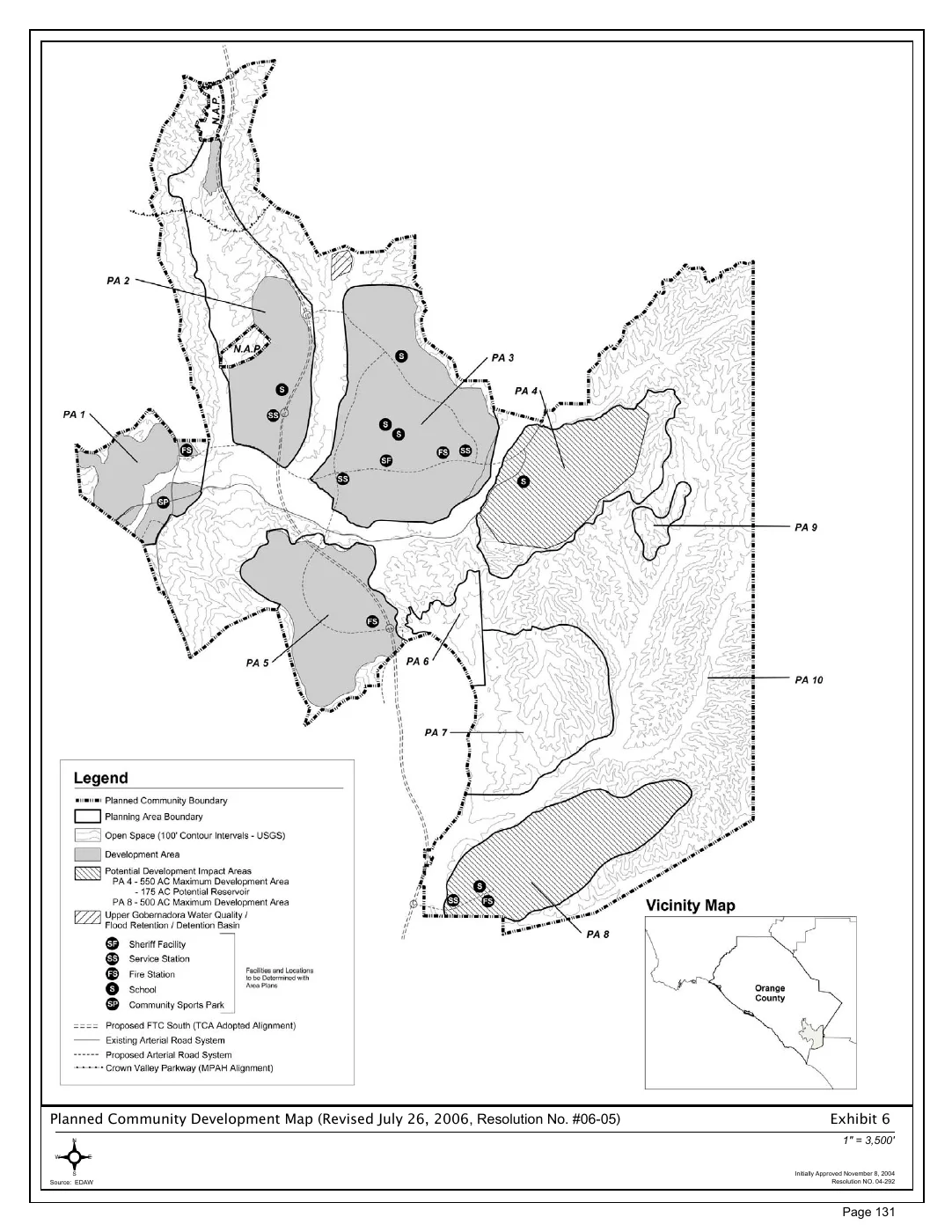
The Ranch Plan map places development areas, open space, roads and public facilities in a shared picture. It is one example of the relationships a planner considers.
Historical example: Exhibit 6, revised July 26, 2006. Map credit: EDAW; document hosted by OC Public Works. No Hesty involvement is claimed.
View the original planning map (PDF) ↗